Danger is higher in some places, times: ‘It’s a very dynamic thing’
NEWPORT, Ore. (KTVZ) – New research by an Oregon State University-led team is beginning to unravel the times of year and locations where whales are at greatest danger of entanglement in fishing gear along the Oregon Coast.
“We’ve been able to geographically locate some areas where the risk of entanglement for whales is higher,” said Solene Derville, a postdoctoral fellow at Oregon State’s Marine Mammal Institute. “We’ve also discovered that risk varies with time. It’s a very dynamic thing. And it varies with responses to ocean conditions.”
The research, outlined in a recently published paper in the journal Biological Conservation and conducted in collaboration with scientists at the Oregon Department of Fish and Wildlife, is important because it provides better tools to manage fisheries, the researchers said.
In this case, the research focused on the Dungeness crab fishery, the most economically important in Oregon. According to the National Oceanic and Atmospheric Administration, commercial Dungeness crab pot gear is one of the most frequently identified gear types involved in entanglements along the West Coast of the United States.
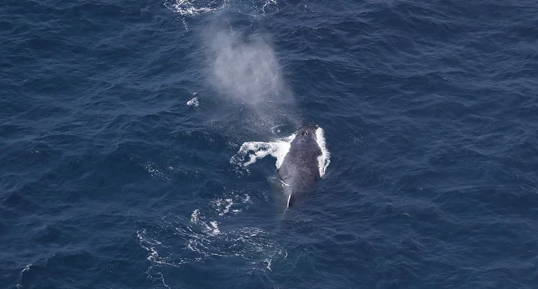
The researchers drew on past work by the Oregon State team that estimated rorqual whale density, including via monthly helicopter flights along the coastline. This work is conducted by the Geospatial Ecology of Marine Megafauna Laboratory led by associate professor Leigh Torres, a co-author of the new paper. The lab is located within the Marine Mammal Institute at Hatfield Marine Science Center in Newport.
The research team predicted monthly whale densities in Oregon, based on variation in ocean and climate conditions for the period 2011-2020. The team then overlaid these maps with data on Dungeness crab fishing locations to determine where and when whales were most at risk of entanglement with crab gear.
Among their findings:
- Entanglement exposure was higher on average in nearshore waters (less than about 240 feet deep) off Astoria, off Garibaldi, north of Newport, north of Charleston, north of Port Orford and at the southern border of Oregon waters.
- Exposure peaked in April, when whales were predicted to occur in greater numbers and closer to shore due to the onset of the upwelling season. Upwelling is the process where deeper, cooler water is pushed toward the surface where it encounters light to support productivity and aggregations of krill that whales feed on.
- Exposure remained constant until the end of the crab season in nearshore waters and decreased past these depths.
- Exposure was lower during the marine heatwave event from 2014-2016 when fishing was more active nearshore and whales were predicted to be less abundant.
- Exposure was higher before (2011-2013) and after (2017-2020) the heatwave, which corresponds with stronger upwelling periods.
Fluctuations in climate and ocean conditions, such as the upwelling events and marine heat waves, appear to be the main drivers of entanglement risk to whales in Dungeness crab fishing gear, the researchers conclude. When this information is combined with time of year and location data, the researchers believe that their findings can support decision making by fishery managers.
“Although there can be inherent tension between commercial fishing and whale entanglements, no one wants to catch a whale and we all want a thriving, sustainable Dungeness crab fishery,” Torres said. “We feel our findings are an important step toward simultaneously achieving both these goals and relieving any tension.”
Craig Hayslip of the Marine Mammal Institute is also a co-author of the paper. The research was funded by NOAA, the Oregon Dungeness Crab Commission, Marine Mammal Institute, ODFW and Oregon Sea Grant. The Marine Mammal Institute is part of the OSU College of Agricultural Sciences.
